Weather Alert in Minnesota
Air Quality Alert issued May 12 at 4:45PM CDT by NWS Aberdeen SD
AREAS AFFECTED: Traverse; Big Stone
DESCRIPTION: * WHAT...The Minnesota Pollution Control Agency has issued an Air Quality Alert for ozone pollution. The Air Quality Index (AQI) is expected to reach the Orange or Unhealthy for Sensitive Groups category. * WHERE...West central, east central, central, south central, southwest, north central, and northwest Minnesota. * WHEN...From noon CDT to 9 PM CDT Tuesday. * IMPACTS...Sensitive groups, such as people with lung disease (including asthma), heart disease, children and older adults, and people who are active outdoors, may experience health effects. * ADDITIONAL DETAILS...Ground-level ozone is expected to be high once again during the afternoon hours on Tuesday across roughly the western two-thirds of Minnesota, including the Twin Cities Metro. Mostly sunny skies, warm temperatures and low humidity will provide a favorable environment for two types of pollutants (volatile organic compounds and nitrogen oxides) to react with sunlight in the air to produce ground-level ozone. Ozone will remain elevated on Wednesday as sunny skies, warm temperatures and dry conditions persist.
INSTRUCTION: Sensitive groups, such as people with lung disease (including asthma), heart disease, children and older adults, and people who are active outdoors, should limit prolonged or heavy outdoor exertion. Reduce or eliminate activities that contribute to air pollution, such as outdoor burning, and use of residential wood burning devices. Reduce vehicle trips and vehicle idling as much as possible.
Want more detail? Get the Complete 7 Day and Night Detailed Forecast!
Current U.S. National Radar--Current
The Current National Weather Radar is shown below with a UTC Time (subtract 5 hours from UTC to get Eastern Time).

National Weather Forecast--Current
The Current National Weather Forecast and National Weather Map are shown below.

National Weather Forecast for Tomorrow
Tomorrow National Weather Forecast and Tomorrow National Weather Map are show below.

North America Water Vapor (Moisture)
This map shows recent moisture content over North America. Bright and colored areas show high moisture (ie, clouds); brown indicates very little moisture present; black indicates no moisture.

Weather Topic: What are Cumulus Clouds?
Home - Education - Cloud Types - Cumulus Clouds
 Next Topic: Drizzle
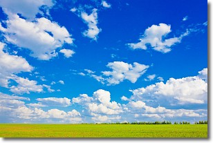
Cumulus clouds are fluffy and textured with rounded tops, and
may have flat bottoms. The border of a cumulus cloud
is clearly defined, and can have the appearance of cotton or cauliflower.
Cumulus clouds form at low altitudes (rarely above 2 km) but can grow very tall,
becoming cumulus congestus and possibly the even taller cumulonimbus clouds.
When cumulus clouds become taller, they have a greater chance of producing precipitation.
Next Topic: Drizzle
Weather Topic: What is Evaporation?
Home - Education - Precipitation - Evaporation
 Next Topic: Fog
Evaporation is the process which returns water from the earth
back to the atmosphere, and is another crucial process in the water cycle.
Evaporation is the transformation of liquid into gas, and it happens because
molecules are excited by the application of energy and turn into vapor.
In order for water to evaporate it has to be on the surface of a body of water.
Next Topic: Fog
Current conditions powered by WeatherAPI.com


